
…
- On foot
- By van · 15,6 km
Laguna de los Tres
From the Río Eléctrico bridge to the lake, then down to town
- distance
- 19.6 km
- elevation gain
- +890 m
- highest point
- 1,177 m
- duration
- 8 to 10 h
- difficulty
- Demanding
Trail conditions: Take care · El último tramo está en estado regular.
Stretch by stretch
The trail cut into stretches, measured on the track. Tap one to see it on the map and the profile.
Download the track (GPX)- On foot
- By van
19.1 km · height 408 a 1,189 m
Route measured on our own track. Touch the profile to see the height at each point.
The numbers
Measured on our own track, with heights from the Copernicus GLO-30 model.
- Walking
- 19.6km
- Transfer by vehicle
- 15.6km
- Total ascent
- +890m
- Total descent
- −932m
- Lowest point
- 414 m
- Highest point
- 1,177 m
- Steepest stretch
- 36 %average grade over 1 km
- Steeper than 15 %
- 4.1 km
- Walking time
- 8 to 10 h
- Difficulty
- Demanding
The trek
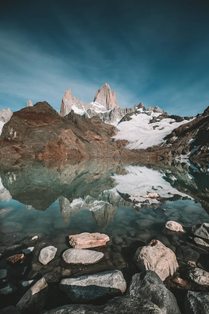
The walk to the foot of Fitz Roy. Almost 20 km, and the last stretch is a steep climb up the moraine; at the top is the lake, with Fitz Roy right above it.
We start at the Río Eléctrico bridge and walk slowly up the Río Blanco valley. As we climb, the valley opens behind us and the spires appear: Saint-Exupéry, Poincenot, Mermoz, Guillaumet and Fitz Roy.

At Río Blanco, the old climbers’ camp, the hard part begins: about 350 metres up the moraine in the last kilometre and a half. At the top the lake appears all at once under the granite walls and the glacier.
We walk back to town past Laguna Capri. Groups are small, so the group sets the pace, not the clock.
How the day goes
- Transfer to the Río Eléctrico bridge
- Lenga forest and the Río Blanco valley
- Final climb up the moraine
- Laguna de los Tres
- Down past Laguna Capri to El Chaltén
What is included
- Professional mountain guide, in Spanish or English
- VHF radio
Extra, if you need it
- Packed lunch
Worth knowing
- The itinerary may change with the weather or trail conditions.
- A good level of fitness is recommended.
- Small groups.
- Tell us beforehand about dietary needs, allergies or medical conditions.
- We send the packing list once your booking is confirmed.
- Private departures are available.
- For safety, the guide may change or call off the route if the mountain asks for it.
Trail guide
Laguna de los Tres hike from El Chaltén: the complete trail guide
The hike to the foot of Fitz Roy, told by people who walk it almost every day: where to start, how long it takes and what the last hour is like.
Laguna de los Tres sits at 1,162 m, right below Fitz Roy, inside Los Glaciares National Park. It is the best-known hike in El Chaltén and, for many people, the best day of the trip. You do not need a guide: the trail is marked and well kept. You do need to be fit, start early and check the forecast, because the last hour is hard and Fitz Roy is not always in view.
The numbers
| Route | Distance | Time | Climb |
|---|---|---|---|
| From town, one way | 10 km | about 5 h | 750 m |
| From town and back | 20 km | 8 to 10 h | 750 m |
| Río Eléctrico bridge to town, via the lake | 19.6 km | 8 to 10 h | 890 m |
From town: official Park figures. From the bridge: measured on our own track.
Two ways to do it
- From town and back
- The trail starts at the end of Avenida San Martín, at the north end of town. You go and come back the same way, past Laguna Capri. It is the simplest option: no transfer needed.
- From the Río Eléctrico bridge to town
- A transfer drops you at the Río Eléctrico bridge, about 16 km north on route 41. A trail climbs to the Río Blanco valley, pass the Piedras Blancas glacier viewpoint and Poincenot camp, do the last stretch and walk down to town past Laguna Capri, never on the same path twice. It is the one we do: you see more and walk less downhill.
Stop by stop
Measured on our own track, starting at the Río Eléctrico bridge:
- 0 kmPuente del Río Eléctrico
- 6.1 kmMirador Piedras Blancas
- 7.1 kmPoincenot
- 9.4 kmLaguna de los Tres
- 15.9 kmLaguna Capri
- 18.4 kmMirador Río de las Vueltas
- 19.6 kmEl Chaltén

The last hour
From Poincenot camp it is only about 2 km, but you climb about 450 m. It is a moraine of loose rock with some very steep parts. People who reach Poincenot feeling fine usually take an hour for this bit. Go at your own pace, use poles if you have them, and save some energy: the way down is just as hard on the knees. In winter, crampons and poles are required.
At the top, once you cross the ridge, the lake appears with Fitz Roy above it. Walk a few minutes to the left along the edge of the moraine and you see Laguna Sucia far below, green, with the glacier hanging above it. Many people do not know and miss it.

When to go, and what time to start
The season runs from October to April. In December there are about 16.2 hours of daylight and no rush; in March and April there is less wind and the forest starts to change colour. Fitz Roy clouds over and clears in minutes: check the mountain forecast the night before and keep the clearest day of your trip for this trail. Starting between 7 and 8 gets you to the top before noon, with time to come down calmly. Read more →
Water, toilets and camps
- Water
- The Park says river and stream water is pure. Bring a bottle and refill on the way. No soap near the water.
- Toilets
- There are dry toilets only at the Laguna Capri and Poincenot camps. None elsewhere on the trail.
- Camps
- Capri and Poincenot are booked and paid per night through the Park’s Friends Association. No fires: stoves only.
The park fee
| 1 day | 3 days | 7 days | |
|---|---|---|---|
| Foreign visitors | $ 50,000 | $ 100,000 | $ 175,500 |
| Argentine nationals | $ 25,000 | $ 50,000 | $ 87,500 |
| Santa Cruz residents | $ 8,000 | $ 16,000 | $ 28,000 |
| Students (Argentine ID) | $ 15,000 | · | · |
Argentine pesos per person, since 1/6/2026. Paid by QR or card; no cash at the booths.
You pay at the booths where the trails start or on the National Parks website. Bring your ID: they ask for it.
With a guide or on your own
You can do it alone, and plenty of people do. A guide makes sense if it is your first time in the mountains, if the forecast is doubtful or if you want to start at the Río Eléctrico bridge without sorting out transfers. We head out almost every day, in groups of up to 8, with guides who live in town and carry a radio.
Going on your own? Read what is worth knowing before you go without a guide. See →
Wind on the way
It is the first thing we check in the morning. Town can be calm while the lake is blowing hard, so we show both heights.
Loading the forecast…
Laguna de los Tres: questions
How long is the Laguna de los Tres hike?
With us, 8 to 10 hours: 19.6 km from the Río Eléctrico bridge up to the lake and down to town, with about 890 m of climbing.
How hard is Laguna de los Tres?
Demanding. Most of the way is gentle, but the last hour climbs about 400 m up the moraine, on loose and steep rock.
Is there a park fee?
Yes: it is inside Los Glaciares National Park. Since 1/6/2026 a day costs ARS 50,000 for foreign visitors and ARS 25,000 for Argentines, by QR or card (no cash). It is not included in the trek.
Where does it start?
We meet in town and drive to the Río Eléctrico bridge, about 16 km along route 41. From there we climb the Río Blanco valley and walk back to town past Laguna Capri.
Is Fitz Roy always visible?
No: it depends on the cloud on the summit. Our mountain forecast shows whether Fitz Roy is in view and which day is best.
What does the guided hike include?
A professional mountain guide, in Spanish or English, and a VHF radio. We drive together to the Río Eléctrico bridge. The packed lunch is optional.
When is the best time?
The season runs October to April: November to February has 14 to 16 hours of daylight; March and April bring less wind and autumn colours. In winter (May to September) you walk with crampons and poles, which are required.
Laguna de los Tres or Laguna Torre? · Laguna de los Tres without a guide · The best hikes in El Chaltén · 2 to 5-day itineraries · When to visit El Chaltén · The National Park and its fee · How to get to El Chaltén · Short hikes
Live
The mountain logbook
What people who walked with us write. Every Google or Tripadvisor review links to the original.
5,0
· Google · Tripadvisor
The logbook opens this season: the first entry could be yours.
Photos
What happens when you book
The full policy →- 01Written confirmationYour place is confirmed once we receive payment and send you the confirmation.
- 02Meeting point and timeThey come with the confirmation. Depending on the trek, we meet in town or pick you up.
- 03What to bringWe send you the list: hiking boots with good grip, warm layers, a waterproof jacket, water and food.
- 04If the weather says noThe guide decides. If we cannot go, we move you to the next date or give you credit for another trek.
- 05If you need to cancel30 days or more before: full refund; 15 to 29 days: 50%; under 15 days: no refund.
Other treks