In El Chaltén the weather decides everything. The same trail can be the best day of your life or nine hours inside a cloud. This page gives you what our guides look at every evening: a live seven-day mountain forecast for each trail, how to read it, the light month by month, and everything practical you need for the 2026–27 season.
Seven-day mountain forecast calculated at the real altitude of each trail. We score every day for wind, rain and — most important — whether the summits will be clear. The same reading our guides do every evening.
| Trail |
|---|
Scores are an automatic guide from the Open-Meteo mountain forecast, not a safety guarantee. Conditions change fast — on a guided trek, your guide makes the final call each morning.Weather data: Open-Meteo.com
Weather apps were built for cities. In front of the Fitz Roy massif, these are the signals that matter.
Rain is rarely the problem — wind is. Gusts above 60 km/h make exposed sections hard; above 80–90 km/h people get knocked off their feet on moraines and summits. Sheltered forest trails stay walkable when the high ones do not.
Total cloud cover means little. What matters is whether low and mid clouds cover the summits around 1,500–3,000 m. That is what our forecast scores above.
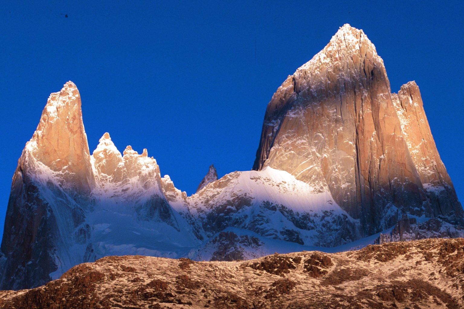
Chaltén means "smoking mountain". A plume streaming east from Fitz Roy's summit means strong westerly wind up high — expect gusts on the moraines even if town feels calm.
Smooth, lens-shaped clouds hovering over the peaks are a sign of very strong wind aloft and often a change in the weather within hours.
On many summer days the summits are clearest early and cloud builds after midday. A 6–7 a.m. start gives you the best chance at the lake.
Patagonian forecasts improve sharply two to three days out. Keep at least one spare day in your plan and move your big hike to the best window.
| Trail | Distance | Time | Level | Best on… |
|---|---|---|---|---|
| Laguna de los Tres | 20–22 km | 8–10 h | Demanding | A clear, calm day — Fitz Roy up close |
| Laguna Torre | 18 km | 7–8 h | Moderate | Most days — icebergs even under cloud |
| Loma del Pliegue Tumbado | ≈ 21 km | 8–9 h | Demanding | The clearest day of your stay — Fitz Roy and Torre together |
| Laguna Capri | ≈ 8 km | 3–4 h | Easy–moderate | Calm mornings — Fitz Roy reflected in the water |
| Mirador de los Cóndores | ≈ 4 km | 1.5–2 h | Easy | Arrival day or sunset — the whole valley and town |
| Chorrillo del Salto | ≈ 7 km | 2–3 h | Easy | Windy or rainy days — a sheltered waterfall |
| Vuelta al Huemul | 4 days | Expedition | Challenging | A stable window — Southern Ice Field views |
Distances are approximate return trips from El Chaltén. Laguna de los Tres guided loop starts at Puente Eléctrico.
Four journeys from our door in El Chaltén. Select a trek to see its route across the Fitz Roy and Cerro Torre massifs.
| Sunrise | Sunset | Daylight | Morning golden light | Evening golden light | |
|---|---|---|---|---|---|
| January | 06:08 | 21:54 | 15 h 50 | until 06:56 | from 21:05 |
| February | 06:59 | 21:11 | 14 h 10 | until 07:43 | from 20:27 |
| March | 07:45 | 20:15 | 12 h 30 | until 08:27 | from 19:33 |
| April | 08:33 | 19:10 | 10 h 35 | until 09:17 | from 18:26 |
| May | 09:16 | 18:19 | 9 h 05 | until 10:06 | from 17:29 |
| June | 09:46 | 17:58 | 8 h 10 | until 10:42 | from 17:02 |
| July | 09:41 | 18:15 | 8 h 35 | until 10:34 | from 17:21 |
| August | 08:58 | 18:54 | 9 h 55 | until 09:45 | from 18:08 |
| September | 07:56 | 19:38 | 11 h 40 | until 08:38 | from 18:56 |
| October | 06:52 | 20:23 | 13 h 30 | until 07:35 | from 19:41 |
| November | 05:59 | 21:14 | 15 h 15 | until 06:45 | from 20:28 |
| December | 05:40 | 21:54 | 16 h 15 | until 06:31 | from 21:03 |
Calculated for El Chaltén on the 15th of each month (local time, UTC−3). Golden light = sun below 6° above the horizon. On clear mornings Fitz Roy turns red in the first minutes after sunrise.
Every hiker in the El Chaltén sector of Los Glaciares National Park needs an entry ticket, bought online on the Parques Nacionales website and shown at the trail portals: Los Cóndores, Base Fitz Roy and Río Eléctrico. As of June 2026 the general rate is ARS 50,000.
El Chaltén is about 220 km north of El Calafate, the nearest airport — roughly three hours by road. Buses run several times a day in season; book ahead in January and February.
Cards are widely accepted, but bring some cash: the few ATMs in town can run out at peak times.
Expect little or no mobile coverage once you leave town. Download offline maps before you start, and tell someone your plan. Our guides carry VHF radios.
Streams in the park are famously clean. Fill up upstream of trails and camps, and carry water for the final climbs where there is none.
No drones, no fires, no dogs on the trails. Camp only at designated campsites and carry out everything you bring in.
With three days you can match the big hikes to the best weather: Laguna de los Tres on the clearest, Laguna Torre on a cloudier one, Pliegue Tumbado when the sky opens.
It can snow in January and be 20 °C in March. Windproof shell, warm mid-layer, hat and gloves go in every pack. See our packing list.
Small-group departures fill up in December–February. Booking ahead keeps your dates flexible to follow the weather window.
December to March has the longest days and most reliable trail conditions. March often brings calmer winds and autumn colours. November and April are quieter but cooler, with snow possible on the higher trails.
Very. Strong westerly winds blow off the Southern Patagonian Ice Field, especially in spring and early summer. Gusts of 60–90 km/h are common on exposed moraines and summits, while forest trails stay more sheltered.
It varies week to week. Clear windows happen in every season, but they rarely last more than a day or two. Staying three or more days and watching the forecast greatly improves your chances.
It uses the Open-Meteo mountain forecast at each trail's altitude and is most accurate for the next 48 hours. It is a planning guide, not a safety guarantee — always check conditions on the morning of your hike.
No — the main trails are well marked. A local guide adds route judgement, weather reading, radio contact and the stories of the place, and lets you move your big hike to the best day.
Tell us your dates. We watch the mountain every day and will match Laguna de los Tres, Laguna Torre or Pliegue Tumbado to the best window of your stay.